Showing posts with label Natural Wonder. Show all posts

Monday, July 28, 2014

Cheltenham Badlands

Sometimes geocaching makes an excellent tour guide.

A case in point:

In June, while we were driving home from the COG mega event, my wife and I decided to avoid the highways and cut across country to see what we could see.  About 30 minutes into our drive along Ontario we crested a hill and landed in the middle of a geology lesson.

On the side of the road was several acres of barren red rocks.  If you've never been to central Ontario, the landscape is basically rolling hills of green fields, green trees, or water. Barren rock like this is rare, so naturally we were intrigued.  However we had no idea what, exactly, we were looking at.  I didn't have data on my phone, so I couldn't search the internet for the answer.

I decided to see if there were any geocaches in the area that may provide some nuggets of information. As luck would have it, there was an earth cache at this very location, complete with all sorts of useful information about the badlands.  I shall relay some of that information to you, cause thats just the type of service we provide here at Only Googlebot Reads This Blog.

According to the earth cache description, this area used to be an inland sea back in ancient times, which covered the land in a very soft rock called shale.  When the land was cleared for cattle grazing back in 1900, the dirt eroded away exposing the shale. Once the shale was exposed it also eroded away, leaving the much harder sand stone, limestone, and dolomite bedrock exposed. The result is the badlands seen today.

What surprises me is how quickly it happened.  One normally thinks of geological events happening over thousands of years, but this all happened over a relatively short 100ish years.  Just goes to show that messing with mother nature can have unforeseen (tho sometimes awesome) consequences.

It was really great discovering that these badlands existed very near the place I grew up, all thanks to this quirky little hobby we call geocaching.  Gotta love it.

Have you had a similar experience where a geocache acted like a tour guide?  Tell me about it in the comments below.

Friday, July 25, 2014

The Comfort Maple


This tree is one of the oldest living things in Canada. At an approximate 500 years of age, this single sugar maple tree is 3 times older than the nation it now resides in, and was almost 100 years old when the pilgrims landed on Plymouth Rock.

It is a gentle giant at 80ft in height, and branches that sprawl out 125ft in circumference.  The trunk itself is 20ft in circumference.  Due to age, and at least one lightening strike, the tree is reinforced with guy wires, and some brickwork in the main trunk.

The Comfort Maple, named after family who purchased the land in 1816, now resides on a one acre public accessible plot of land surrounded by a farm in Pelham Ontario.

It is also home to a geocache, that has been missing the last few times I've been to Canada - I finally put my name on the log in July.

Sunday, July 06, 2014

Eternal Flame Water-Wizardry

What you are looking at is one of the most Tolkienesque waterfalls I have ever seen. One expects a Hobbit, or an Ent, to appear around every corner.

Or a wizard.

Take a closer look at the middle.  See that glow? That is fire.  Yes, this waterfall is on fire.

Definitely wizard work.

What you are really looking at is the Eternal Flame waterfall, which lives in a canyon just south of Buffalo New York.

Today I took my family on an adventure to check out this natural wizardry for ourselves.

To get to the falls is a round about path way.  It starts with a nice walk down a well groomed dirt path for about 2/10ths of a mile.   Then you start heading downhill... rather steeply (don't worry, there are stairs for the really hairy bits).

This picture is actually from our return trip, so picture it backwards in your minds eye as you descend into the canyon.
The terrain was actually harder than I expected.  I really got worried when I found out the last 1/10th of a mile was hiking along a creek bed.  The kids ended up doing much better than I ever hoped, and they had a blast as they crawled over rocks, fallen trees, and splashed in the many, many (many) puddles.
Eventually we arrived at the water falls.  There isn't a great deal of water - its more of a constant sprinkle, but it is high, and on fire.  Can't say that about too many waterfalls, can you?
This is a closeup of the flames.  The flames are sustained by natural gas (i.e. methane, or in 4 year old parlance, earth farts).  The natural gas leaks up out of the shale, and when lit, becomes the awesome freak of nature you see before you. The flames are in a little grotto, which protects it from being extinguished from the falling water.
Once we sufficiently checked out the wizardry, and convinced ourselves that the Hobbits were not coming out today, we headed back down the creek bed.

Onward to the next adventure!

Sunday, August 04, 2013

Bears Go East: Prince Edward Island

The following events happened on July 12th, 2013
Our travels on our epic road trip east have brought us to the small green island province of Prince Edward Island.

We had spent the night in Charlottetown, PEI, so we woke up ready to seize the day by exploring the island.

We headed west to check out some of the beautiful scenery.  One thing we noticed is that a lot of the coast line is not developed like it seems to be in many other places.  Many farm fields ended at the waters edge, which made for some stunning imagery.

One of our first stops was a wonder of nature: the squeaky sand beaches in Souris PEI.  Yes, that is right, sand that squeaks.  When you walk on it it makes a distinct squeaking sound, almost like walking through crisp snow.  There are only a few places in the world where this phenomenon occurs, and we were lucky enough to be standing on one of those spots.

I told Zeke about the squeaky sand beaches before we left, and he has been looking forward to it for weeks.  When we arrived he raced excitedly up the sand dune to get to the squeaky stuff as quickly as he could.

After we were finished with the beach (well, three of us were done, I am quite sure Zeke would still be there if we let him) we headed over to the very eastern tip of PEI to visit a lighthouse.

The East Point Lighthouse (PEI has a tendancy to give obvious names to things) is one of the few octagonal lighthouses on the island.
There is a cafe right beside the lighthouse where we had lunch (some amazingly tasty clam chowder - perhaps the best I've ever had).  We then headed back towards Charlottetown along the northern coast, and did some geocaching along the way.

I grabbed my planned caches, and was about to head straight back to Charlottetown when I noticed that every other person in the van was sound asleep (yay for nap time!). Since we would not be able to do the exploring in town we planned on with napping folk,  I made the command decision to do some more geocaching.  I found a series of caches along an old dirt road, and spent the next hour grabbing those caches. I continued until my wife started to wake up, then we continued on our planned itinerary (quilt shopping and a walk through downtown Charlottetown).

We had a lot of fun today, as evidenced by this shot of the kids playing on a squeaky beach:
Bears, like sand people, walk single file to hide their numbers.

More shots of the squeaky sand beach. There are some caches here (traditional, and an earth cache), so we ended up well away from the tourist areas of the beach, so we had the place essentially to ourselves (aside from one local dog walker).

Prince Edward Island is a very lush green province with striking red dirt.  Everywhere you look is bright greens with interesting flowers.  It is a very pretty place.

The East Point Lighthouse allows visitors to go up to the top, which we did.  The light is still on.

As you can imagine the view from the top is quite spectacular.

The stairs were quite steep in places. Even Abigail was using the handrail.

So that ends our visit to Prince Edward Island.  We have managed to visit all four Maritime Provinces and its time to turn the Geovan of Destiny back towards home.  We're not quite done with our trip yet! There is plenty more to see on the way back. Stay tuned to find out what is in store for these travelling bears.

Friday, August 02, 2013

Bears Go East: Cabot Trail

The following events happened on July 10th, 2013

Canada is an amazingly beautiful country, and one of the most awesome places in the Maritime provinces is the drive around the north east section of Cape Breton Nova Scotia, known as the Cabot Trail.

The Cabot Trail is 185 miles of some of the nicest scenery you'll ever see - coast lines, mountains, rugged terrains, quaint towns.   It has it all.

The confluence of events from our epic road trip east has conspired to place us at the doorstep of the Cabot Trail, and today we drove the whole dang thing.

We spent most of the day in the car going from cache to cache along the trail, so there isn't a great deal to talk about except to wax on and on about how awesome the scenery is.  Suffice to say, we did a lot of viewing, like this:


 ... at vistas, like this:
We did schedule in a 2 mile hike, so we could experience the landscape first hand, instead of through a windshield.  Its hard to take in such hikes with a toddler and an infant, but we managed to get everyone down to the scenic point and back safely.
The view was well worth it.
It did wear out the kids tho.  Zekey made it a whole 5 minutes when we got back to the car before he crashed:
Fishing is a big industry in Nova Scotia.  Fishing boats and lobster traps are a common sight pretty much anywhere you go along the coast.
One never gets tired of seeing views like this.
This beach had several inuksuk.  Nothing says Canada more than inuksuks. 
This is the last view we had from the Cabot trail.  It is a quaint little fishing village.
After this we headed back to the hotel for some food (donairs!) and sleep.  We are hitting the road early tomorrow to get a change of scenery.  Where are we going?  Whats next for the bears?  Stay tuned to find out!

Friday, July 26, 2013

Bears Go East: Fun(dy)!

The following events happened on July 3rd, 2013
I am currently in the middle of a 3 week road trip to explore the north east of North America. We are driving from our home in North Carolina to the bonny isle of Newfoundland, and back.  Along the way we are packing in as much adventure as a carload of toddlers and infants can manage.

This morning we left the hotel just outside Bangor Maine and headed north across the border to our native homeland of Canada.

We grabbed a cache and explored a scenic lake in Maine before making the uneventful crossing into New Brunswick.

I had planned to geocache our way to our destination, but half way through the day we changed plans. As a result we were able to visit a wonder of nature we were not going to be able to otherwise (It did mean I got fewer geocaches today, but geocaching is about the adventure, not the numbers, and as you will see, the adventure was worth it).
These boats only sail at high tide, apparently.

We also ended up with an unexpected theme for the day - The Bay Of Fundy, and its natural wonders.

As you may be aware, the Bay of Fundy sits between New Brunswick and Nova Scotia, and it boasts the highest tide range in the world - 50ft on average.  As a result it has some rather interesting geological attributes.

The first we encountered during our day is the Reversing Falls in Saint John NB.  The name of the falls is not metaphorical.  Like most rivers, it generally flows from the land towards the sea. This is simply due to the fact that the land it at a higher elevation than the oceans are.  When the tides in the Bay of Fundy start to rise, the sea level rises above the level of the river.  At this point the water reverses direction and starts flowing up river.

The Reversing Falls can be seen in the background here.  Currently the water is flowing out to the bay.
 The next stop was the flower pots at Hopewell Rocks.  The flower pots are a series of tall water-carved rocks that were formed by tidal erosion.  During low tide one can walk on the floor of the bay, and check out these tall monuments first hand.  Originally we were going to visit these tomorrow when the tide was high, however we realized we could make it for low tide today, which was what prompted the change of course and a most excellent addition to our adventure.

As you can see the flower pots extend a very long way along the edge of the bay. There is an earthcache that can be found down here.  Walking on the ocean floor *and* a smiley?  Yes please.

The second Zeke hit the bottom he had one goal:  to throw a rock into the ocean.  I am happy to report that a few minutes later he achieved this noble and monumental goal.

The bottom is a mix of rock and mud.  Zeke found some of the muddy spots and got his shoes covered.  I won't tell mommy if you don't.

The final Bay of Fundy related wonder of nature is something called a tidal bore, or really its a mini tsunami.   When the water rises in the Bay of Fundy, the tidal surge pushes a wave, which can be up to 2ft tall, up the Petitcodiac river.  As the tidal bore comes in the direction of the river changes from flowing down stream to up stream, and the water level can rise 7 metres in just over an hour.

The Petitcodaic river runs right past our hotel, and it was scheduled to pass at 7:39pm (with a 20 minute variance on either side).  So once we checked in, we ordered in some food, sat on the patio along the river, and waited.  The tidal bore is also an earth cache.  It was the easiest earth cache I have ever logged.  I didn't even have to move from my table.

This is the view of the hotel from about 0.2 miles down stream.  As you can see the water is rising, and turning blue.

So we are spending the night in Moncton NB. We have already accomplished our planned activity for tomorrow morning, so we should have an easy drive to our next destination. Where is that going to be? Stay tuned!

Saturday, August 25, 2012

Geocaching Adventures: Niagara Falls

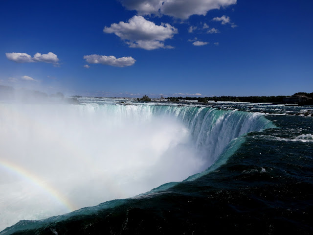
Tuesday was a busy day for me. I started the morning with a walk around Queenston Heights, then after lunch I toured a ghost town, and then to finish off the day I headed to Niagara Falls to explore one of the worlds natural wonders.

I also had some geocaching business to take care of.

I have been to the falls many times  - my first date with my wifey was partly at the falls, and we've been there many times since - but visiting  the falls itself have always been a secondary activity, and I didn't get a lot of time to simple sit and take them in.  So Niagara Falls seemed like a great location to end my day of wandering.

First to business.  I had picked up a travel bug a few weeks ago at an event.  The bug was a brass looking anchor with Niagara Falls Canada written on it (odd, since it was released in California, but who am I to judge?).

The goal of the bug is to travel to boats, light houses, and places that have monuments with anchors.  Even tho it didn't mention water falls, I knew I was heading to the bugs namesake, so I figured I should take it with me.  I checked the bug into the Earth Cache at the falls, and took this photo -->

My duty to the travel bug taken care off I then found the Tim Hortons and got an Ice Cappuccino (aka liquid crack for Dave), sat down beside the falls, and took in the scenery.

Once I was refreshed from my delicious beverage I moved on and went down the Niagara River a mile or so to find the most visited traditional cache in Ontario (according to the cache description)  Foundations:  Ghosts Of The Clifton.  The description also says that the chances of meeting fellow cachers while doing this cache is high as a result.

The cache is in an out of the way courtyard that is easy to miss by tourists.  I arrived and had the place to myself.  I quickly found the cache, and sat down  on a nearby rock to open it.  As I sat I noticed a family enter the area, the mom had the tell tale signs of a geocacher (Walking slowly, GPS looking device in one hand, intensely interested only in objects that could hide things).  I put the cache behind my back.

When she got close enough and caught my eye, I showed her my GPS.  She laughed and asked if I had found the cache yet.  That is when I pulled the container out and showed it to her.  We talked for a bit, and then they moved on.  I had to wait another 5 minutes or so to replace the cache as some proper muggles came by as I was signing the log.

Eventually everything was placed back as it should be, and I headed across the street to the Hard Rock Cafe for a beer and poutine for desert.  Afterwards I drove back home.

It was a wonderful end to a great day of exploring and caching.  Here are some more pics from Niagara Falls.


I added this life rule after today: Any adventure that includes a natural wonder of the world doesn't suck.