Showing posts with label awesome. Show all posts

Tuesday, September 22, 2015

Best Of Show

Yesterday I submitted some photos to the local county fair.

Today I took the family over (well, my wife drove, so technically she took us, but I was a willing co-conspirator and tag-alonger).

While there, we dropped by the judging barn to see how we did.

Turns out I got first place, and Best Of Show.

w00t.

So now I can add "award winning photographer" to my resume.

The picture is below.


Saturday, February 21, 2015

A Personal Geocaching Map

A few months ago I discovered that a geocacher by the name of Cajun Abear makes these awesome custom maps based on ones geocaching history.  I contacted him about making my own map to celebrate my 4000th find milesone, and he just put the finishing touches on it last night.

This is, honestly, one of the coolest geocaching souvenirs I've ever heard of, let alone got my hands on.

Here is that map (click to see an larger version):


As you can see it has an incredible amount of detail about my caching career, including:

- Mega events I've attended.

- My extreme caches (farthest north/south/east/west, 5/5's, highest/lowest elevations).

- Milestones

- Delorme challenges.

- First to find of each cache type.

- Most number of cache types found in the same day.

- My three largest geocaching road trips (my personal favourite panel)


The cool thing is that these maps are made for free, tho a small donation to help pay for his software is requested.  He just does it for the love of making maps, and to give back to the geocaching community.

If you would like to get your own map, you can start here: https://www.facebook.com/wayne.hebert?fref=ts

The generated map is large enough for an 18x14in print, so I am going to find a place to get this printed off.  It is going to look awesome on my office wall.

Sunday, September 21, 2014

Final Approach: An Awesomsauce Geo-art Extravanza

On July 23, 2014 a new geo-art series called Final Approach was published just north of Greensboro North Carolina

As soon as I saw it I knew just the group of folks who would be perfect for this mission: Team Awesomesauce.

You may remember Team Awesomesauce from our powertrail adventure in Tennesee in early July. The team includes Yours Truly, HoosierSunshine, FailedApparatus, NCBiscuit, and the enigmatic NinjaChipmunk.

Yesterday Team Awesomesauce suited up and met in a Walmart parking lot near Greensboro North Carolina, jumped into a rented "Geovan of Destiny"-esque mobile, and set off on an epic quest to turn this series of artisnal question marks into smiley faces.

The quest led us on a series of back roads that weaved through some picturesque North Carolina countryside.
Most of the geocaches themselves were simple PnG style hides. We each took turns jumping out of the van to make the grabs.  Here NCBiscuit is doing her part.
I did the navigating, and jumped out on occasion to find a cache or two.  I tried to add some style to this one.
HoosierSunshine, despite having a sore ankle, also got into the geocaching log signing spirit.
 FailedApparatus did all of the driving (as the Geovan was rented in his name) but he still did his part to grab a few caches.
Alongside her cache retrieval duties, NinjaChipmunk took on her roll as photographer sniper. Here she is in a stunning action shot.  Note the intensity and sneakitude of taking the shot from the open van door.
There are 82 caches in the series.  We signed each long with Team AZMSCE (cause writing is hard):
6 hours later, including several pit stops, a delicious lunch, and... um... hair treatment...
... we accomplished our goal.  One airplane worth of question marks converted into happy faces.

That is a lot of smilies.

We found a few additional caches along the way. By the time we finished the day we had logged 94 geocaches in total.

Team Awesomesauce has now gone our separate ways, and slid back into the murky shadows of our cover identities as civilians.  However, you never know when another mission will call, and Team Awesomesauce will suit back up and ride for on another epic quest.

Stay tuned!

Wednesday, August 06, 2014

Virtual Reality On A Budget

In what is possibly the coolest merging of low tech and high tech, one can now get a very passable virtual reality headset for your Android phone, for approximately $10.

Best part: it is made out of cardboard, with two simple lenses, and a magnet.

It sounds like something an 8 year old would build, but it was actually designed by Google engineers, and it actually works as advertised. Almost like magic.

It is called Google Cardboard, and is basically a cardboard box that holds your phone in front of your eyes in just the right way to allow for a 3D effect.  It then uses your phone display and sensors to show you 3D images that respond to your movements.

To use it you need to download the Cardboard app (free from the Play Store), which has several demos included, such as (among others):  YouTube, Street View, PhotoSphere viewer, and a Google Earth Viewer.

The amazing thing is that it works fantastically well (especially considering it is made from the stuff most other things are shipped in).  I tried out the Google Earth viewer, and you can navigate the world in 3D simply by moving your head around.  This is pretty much what you would expect from any VR headset - but the effect is astoundingly effective.  The resolution is a tad lower than a normal Android display because you are splitting the equivalent of an HD display, however, half an HD display is still a lot of pixels to play with.

Icing on the cake is that it works while wearing glasses, so there are no focus issues for us weak-sighted folk.

It works by splitting the phones display into two halves with the correct parallax distortion between the two to simulate 3D.  You can see how it looks in the screenshot below (looking at the Chicago skyline in the Google Earth demo).

So far the only downside I can see is that it eats your cell phone battery like a fat man at a Chinese buffet, so you'll want to keep your charger handy.

It is impossible to show you what the experience looks like, so you'll have to simply go check it out for yourself.  For $10 it is quite possibly the cheapest entertainment going so you have little to lose. You won't regret it (just make sure you have a compatible Android phone - only a few models are proven to work so far).

You can check out the details for yourself here: https://developers.google.com/cardboard/, and either build your own viewer, or buy one off Amazon.

Tech is finally mind blowing again, and it is awesome.

Disclaimer: As a Google employee I try to stay away from mentioning Google products on this blog - partly to avoid any conflict of interest issues, and partly because this isn't really a tech blog. All opinions are my own, and may not represent Google Inc's stance etc. Aside from sharing a CEO, I have no contact or connection with the folks that built this technology. I didn't really knew it existed until a Cardboard set was handed to me this morning. I am, however, a freshly minted fanboy of the whole idea of VR on the cheap.

Friday, August 01, 2014

Fortuitousness

Sometimes fortune smiles on the unfortunate.

Case in point: On the last day of our adventure at the COG Mega event in June, my bike, the Geobike Of Destiny, developed a flat tire.  This was the second time this happened that trip, and I was out of spare parts.   I had a whole week left on our trip, so I was looking at a week without a bike... 7 days is a long time for me to be without two wheels.

While on the way home we randomly decided to stop for a cache.  The cache is in a garden shed in their backyard (with clear instructions where to go, so while it felt weird walking into a strangers back yard, I was also confident it was the right yard).  As we walked up I noticed the cache owners were home, and we said heya.

We proceed to find the cache... one of the largest caches I have found to date.  It was also one of most well stocked caches: stuffed animals, books, knick knacks, life jackets etc.

The lady CO (sorry, I forget your names - I suck that way),  insisted we grab some items from the cache, even tho we didn't have swag to trade.  One of the items was a bike tire repair kit.  I immediately grabbed it, and told the CO how fortunate it was we dropped by, and explained the situation with my bike tire.

She smiled at me and informed me that the male CO (more personal name recall suckage, sorry again!) was a master bike mechanic, and ordered me to fetch my bike, which was on the back of the Geovan of Destiny.

10 minutes later I had a patched front tire, an adjusted rear tire, a lesson in bike repair,and provided with parts to help do emergency patches in the field.

This was, by far, the more fortuitous impromptu cache stop I have ever made, and confirmation that geoachers the world over are some of the best folks in the world.

If you have the chance, I highly recommend their cache: Shedding the Past: A Whole New Cache on Scene (GC2HNAM). The 107 favourite points are well deserved, and I can speak with personal experience that the cache owners are fantastic people.

Thursday, March 13, 2014

Esse Quam Videri From Space!

While doing planning for a cache run in Raleigh NC I ran across this little gem in Google Earth. 

This lives at the North Carolina Art Museum, which is rapidly becoming one of my favourite places to hang out (it is the place that also contains the life sized Camera Obscura).

This is art that was not even possible 150 years ago... it was made specifically to be viewed from aerial photography.  Each letter is unique.  In short, its awesome and superb, and its mere existence makes me happy.

Sharp eyed folks may notice that the "I" in "this" has words written on it. They are the North Carolina state motto "To be, rather than to seem", which is translated from the latin "esse quam videri" and means "Few are those who wish to be endowed with virtue rather than to seem so.", or in other words "there are many folks who want to be known as good, but only a few who want to be good".  (note: at this stage I wish NC picked a cooler motto, but "live free or die" is already taken).

I headed over to the NC Art Museum and checked out the art from ground level.  This is the view from 0ft relative elevation:


As you can see, it is much more impressive from the air. If you know what you are looking for you can make out the letters, but if you were just a random passer-by, you'd never know you were walking through this aerial piece of artwork:

Cool, eh? Check out the art work for yourself by clicking on ye olde Google Maps link here.


Have you seen similar bits of aerial artwork in your travels?  Let me know about them in the comments!

Monday, March 03, 2014

What Is At The End Of The Sidewalk?

For those that may be curious to know what exists Where The Sidewalk Ends from yesterdays post, it is, apparently, this guy:


It is a southern black widow 50cal geocache.  It does not bite, but it does have lots of swag.

Wednesday, January 15, 2014

100,000

My blog has hit a bit of a milestone.  Today I hit 100,000 page views, which I think is pretty awesome considering this blog is basically just a personal diary I started because my wife (then fiancĂ©) told me to.

I don't do any marketing, aside from posting things to my G+ account, so all of these page views are from folks who have stumbled across my path.

So this means that stuff I wrote has been read 100,000 times by... people (I suspect 99,990 of these page views are from my wife, and 9 from my mother-in-law.  If the other one is you - thanks!). On the other hand, they say on the Internet no one can tell if you are a dog, so if you are a dog and are reading this... squirrel!

So to all you fine folks who have faithfully visited this blog in the past, and especially those who have commented, thanks for reading! I do appreciate it (tho it does beg the question: what the heck is wrong with you? :)

Cheers!

Friday, January 03, 2014

Caching With Melissa

Thursday was my last day in Canada for this trip.   It was also a dark and stormy day - lots of snow, wind, cold, and all the joys that Canadian winters have to offer.

Since I was destined to head back to North Carolina where days like this simply do not exist (much to the delight of the natives), I wanted to get in one last day of geocaching in a proper winter situation.

My sister-in-law, Melissa, decided to join me.  This was her first time geocaching, and was excited to go out adventuring.

We went to the Marshall Memorial Forest near Dunnville Ontario.  It has miles of hiking trails, and, perhaps more importantly, two unfound geocaches.  

The temperature was frosty (14F) with a strong wind bringing the windchill factor closer to 0F.  We got 4-5 inches of snow over the past few days, with more still falling (really, its a storm situation that makes even the most adventurous folks think it may be a good time to catch up on the hockey games recorded on their TiVO).  Perfect weather for an adventure.

So, long story short, we worked our way down the trails and found our first cache.  We both identified the likely hiding spot, and I made the actual grab.  We then moved on to the second cache.  I spotted the cache first, but I wanted to give her the experience of making a find, so I let her find and retrieve the cache all by herself, as shown in this stunning re-enactment:

Melissas exact words after finding the cache was "I love this! Lets go find some more!".

So we headed off back through the woods.  The forest itself has a lot of wooden walkways so folks can avoid slogging through muddy trails, which is highly convenient, tho a little superfluous (since all "mud" is now frozen solid) and dangerous (hard to see where the walkway ends and the drop-off begins, under all the snow). It does do a great job of marking the path.
One last view of the forrest before getting back in the car...
The walk back to the car was across a field, and the wind was getting dangerously cold, and the storm was really picking up, so we decided to get some hot beverages from Tim Hortons and head back to the house.  Once we got there we talked geocaching some more, and I looked up some geocaches near where she lives when she's not at her parents place for the holidays.  She also said she is going to get her boyfriend out geocaching (tho he doesn't know it yet).

I think she's hooked.

So thats my last dose of Canadian winter caching for a while.  I am sad to see it go, but, man alive, is it ever fun.


Friday, November 29, 2013

Black Friday On the Neuse River Trail

Today I celebrated the great American tradition, Black Friday, the way God intended it to be done... by enjoying nature.  Specifically I biked the Neuse River Trail in Raleigh NC, and did some geocaching along the way.

The Neuse River Trail, or NRT, is 27.5 miles of paved trail that runs along the Neuse River on the eastern side of Raleigh NC.  Since we planned on being in Raleigh for the other great American tradition, Thanksgiving, I decided to plan ahead and bring my bike to do the trail.

Since days are shorter this time of year, I got my wife to drop me off at the northern end of the trail at daybreak.  I then spent the rest of the day biking my way south.

I brought my mountain bike as I expected to ride off trail at each geocache.  Most of the caches were within 100ft of the trail, so I typically parked by bike by a nearby tree while hunting down those elusive containers.
The morning was cold, starting at 29f.  I spent the first two hours riding in freezing temps, and riding on frosty trails.  If you look closely you can see frost on the hand rails of this bridge.
As you may have guessed, given the name, the trail runs along the Neuse river.  It actually crosses this river several times.
It was not obvious when I set out, but the trail is not continuous. The top 9 miles end at a soccer field complex.  I asked some locals how to get to the rest of the trail, but they had no idea.  I ended up riding surface streets for a mile or so until I got to the next access point.  A rather annoying detour that took almost an hour out of my morning.
The cache density is almost like a power trail, but they are much more diverse than a typical power trail. Each hide was unique, and like all good geocaches, highlighted the interesting bits along the trail, like this cache hidden at a river overlook.
I ended up riding 28.5 miles, which is the longest bike ride I have ever done. When my wife picked me up at the southern end at 4pm, I was completely beat.  It was compounded by the fact I had to carry 20lbs of backpack with me (I am currently on-call for work, so I needed to bring my work laptop and various accessories in case I was paged - luckily I was not).  Still,I managed to grab 53 caches along the way.   This was definitely a Black Friday for the record books...


... and I didn't even have to set foot inside a store.

Monday, September 16, 2013

Geocaching Adventures: Persistence or Luck?

 - or - 
Sometimes It Pays To Be Lucky

Today I signed the log book on a rather tricky four stage multi-cache, despite not finding all of the stages.

It went down like this.

The cache in question is situated along an old road, now long abandoned.  The cache description does not provide any details about what used to be in the area, rather it asks the question "what did they use this place for?".

Stage one was 800ft or so down the trail from parking, which was a quick hike down the road.  Aside from fighting with then plethora of spider webs cross crossing the overgrown road, I had few issues finding the container for stage one.  As you would expect,  the container contained the coordinates for the second stage, and a hint.

I loaded the coords into my GPSr and headed down the road to the second stage GZ, about 500ft away.


When I got there I was faced with a series of rock faces, many with deep crevices. These were built into a very steep hill.  The rocks went up about 8ft, and the hill rose 30ft above that.   I started my hunt in the rocks, but came up empty.  I then searched all the trees I could reach, but came up empty.  I didn't want to climb the hill as it was incredibly steep - the closest to a cliff one can get without actually being vertical.  Eventually I gave in and climbed up the hill, searching every rock, tree, and crevice in a 50ft radius.

Nothing.

I pulled out my cell phone and looked at the cache description, scouring the logs for clues.  The listing contained spoiler photos for each stage, so I pulled up the photo for stage 2.  I matched up the photo exactly, and looked around.

Nothing.

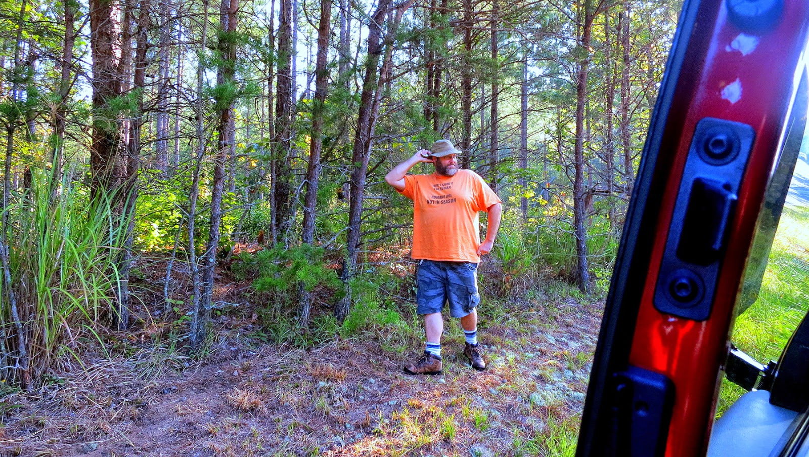
At this stage I had looked for well over 45 minutes, and done some aerobatics that I wasn't sure I was even capable of (still not sure, but based on the evidence, but eye witnesses say its true).  I was tired and frustrated.  I decided to call it and head back to the car.

I took a couple steps towards the car when I remembered something I saw while investigating the logs and photos on the cache listing.  They mentioned an old bridge abutment.  I had yet to see this abutment on my journey so far.  Since I had come this far, and the multi seemed to be following the old road, I figured I might as well see if I could at least find the old bridge.

I did a 180 and continued further down the path.


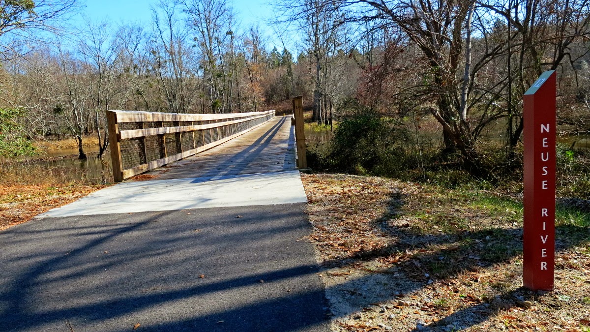
It turns out the remains of the bridge started just 300ft down the road.  The abutment in the spoiler photo was the last in a series of 4 old supports that used to hold up a bridge that the road I was walking on used to go across a wide creek about 200ft away, down in a holler (southernly speaking).

Wanting to take a closer look at the ruins, I hopped down into the brush.  I looked around to see if I could see any obvious hiding places for a geocache. I got to the last support and gazed across the creek.  It was a pleasant view.  I was glad I stayed to explore the area more.


I did one more look around, and took a few photos, when I saw something in the corner of my eye.

They looked like coordinates (queue Spock like raised eyebrow).

A closer look confirmed that they were indeed coordinates.  Holy crap!  I was back on the hunt!  I entered the coordinates into my GPSr, and they led me along the creek bank about 300ft.  Excitedly I followed the arrow through the woods.

I quickly got to ground zero, located the container (a 5 gallon bucket), and excitedly signed that log.

Another multi-cache in the bag, even tho I only found 3/4ths of the stages.

Sometimes it pays off to be persistent, and to explore.  You never know what you'll find.  It may just be a smiley you wrote off for dead.

Oh, and the answer to "What did they use this place for"?  I still have no idea, but now its used, sadly, as a tire dump.  Oh well, at least the walk in was awesome.

Thursday, November 18, 2010

An Awesome Book

I don't want to ruin the surprise, but I just ordered my 1 year old son, Zeke, "An Awesome Book" for Christmas.  The message inside was just to important to pass up.  As long as you promise not to tell Zeke,  you can read the book for yourself:

 http://veryawesomeworld.com/awesomebook/inside.html

Never stop dreaming.